Strong Storm Bringing Rain, Snow for the Weekend
By Chris Sorensen
A cool and relatively dry Wednesday will give way to a series of systems over the next few days that will bring more rain and snow to southern Colorado.
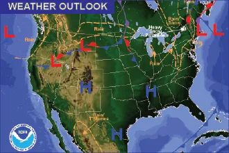
A trough will be shifting to the east Thursday, bringing an increasing chance of showers across the region throughout the day into the evening. While less than one-tenth inch of rain is generally expected across the plains, amounts could be significantly higher where thunderstorms occur. Temperatures in the 50s and 60s are expected.
Forecast models are in close agreement for a much stronger system to move into Colorado Friday and Saturday.
Friday will be mild ahead of the storm, with temperatures in the 50s, however the chances of rain increase later in the day as moisture and much cooler air moves into the area. By Saturday morning, precipitation starting as rain is expected to change over to snow across most of the plains as temperatures drop. North winds will be around 20 miles-per-hour, with gusts to 35 mph possible.
Winter weather alerts are expected Friday night into Saturday. Be prepared to check road conditions at www.cotrip.org if you are planning to travel during the period. Check back for updates.


