El Niño heads toward record strength after Kiowa County's wettest September and October on record

El Niño grew stronger again in October, and federal forecasters now give it a better-than-even chance of becoming the strongest on record. The news comes on the heels of the wettest September and October Kiowa County has seen in more than 130 years of records.
The Climate Prediction Center said Thursday that ocean temperatures in the east-central Pacific, the region forecasters watch most closely, ran 2.5 degrees Celsius, about 4.5 degrees Fahrenheit, above normal in its latest weekly reading. Near the coast of South America, the water ran 4.4 degrees Celsius above normal.
The center put the chance of a strong or very strong El Niño lasting through January to March 2027 at greater than 79 percent. It gave about a 60 percent chance that the event will top every El Niño since 1950 this fall and early winter.
The center measures El Niño with an index averaged over three months. The record on that index is 2.40, set in the winter of 1982-83. The latest value, for August through October, is 1.97 and still rising.
The center said it expects El Niño to keep strengthening and then begin to weaken early in 2027. Even an event this strong does not guarantee the usual effects, it wrote, only that "the chances of experiencing impacts consistent with El Niño are higher."
What El Niño has meant in Kiowa County
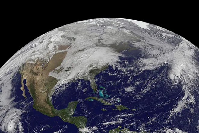
During El Niño, the trade winds that normally push warm water toward Asia weaken. The warm water spreads east across the Pacific and shifts weather patterns around the world. In the United States, it tends to strengthen the southern branch of the jet stream, which steers storms across the southern half of the country.
Kiowa County's own records lean in its favor. The Kiowa County Press compared precipitation from November through April, the county's dry season, with the Climate Prediction Center's El Niño index for every winter since 1950-51.
There have been seven strong El Niño winters in that time. Six of them brought more precipitation than a typical winter in Kiowa County. Together they averaged 4.32 inches from November through April, about 40 percent more than the 3.09-inch average for all winters.
The wettest of the seven was 1972-73, with 5.98 inches, followed by 1982-83 with 5.44 inches. The only one that came in below normal was 1965-66, with 2.59 inches. The typical winter in the county brings 2.82 inches.
Most of the extra precipitation came in the fall and spring rather than in the middle of winter. During the 2015-16 El Niño, December through February brought only 0.43 inches, less than normal. But the full season from November through April brought 4.81 inches, well above normal.
Seven winters is a small sample, and none of them was as strong as this one may become. In September, the Colorado Climate Center cautioned against drawing firm conclusions from only a few events.
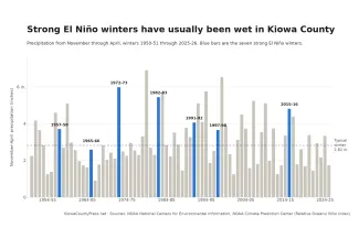
Kiowa County precipitation from November through April for each winter since 1950-51. Blue bars mark the seven strong El Niño winters. Kiowa County Press chart; data from NOAA's National Centers for Environmental Information and Climate Prediction Center
A wet fall has already ended the drought
The county did not wait for winter. Kiowa County received 7.61 inches of precipitation in September and October, according to preliminary figures from the National Centers for Environmental Information. That is the most for those two months in records that begin in 1895, ahead of 6.48 inches in 1941. The 1991-2020 average for the two months is 2.02 inches.
The rain wiped out the county's drought. On the U.S. Drought Monitor map of September 8, 95 percent of Kiowa County was in severe drought and 43 percent was in extreme drought. The October 27 map showed the county free of drought for the first time since March, and it has stayed that way through the November 10 map.
Colorado as a whole has improved more slowly. The share of the state in drought fell from 89 percent at the start of September to 38 percent on November 10, and parts of the mountains remain in extreme or exceptional drought.
What forecasters expect this winter
The Climate Prediction Center's seasonal outlook, issued October 15, favors a wet winter on the eastern plains. For December through February, it gives Kiowa County and its neighbors a 40 to 50 percent chance of above-normal precipitation. The odds tilt the same way, though less strongly, across much of the rest of Colorado, while the northwest corner has equal chances of a wet, dry or normal winter. Winter temperatures are a toss-up across the state.
The center will update its seasonal outlooks November 19. Its next El Niño discussion is scheduled for December 10.