Softball-size hail near Chivington tied Kiowa County's record, and came later in the year than any big hail before it

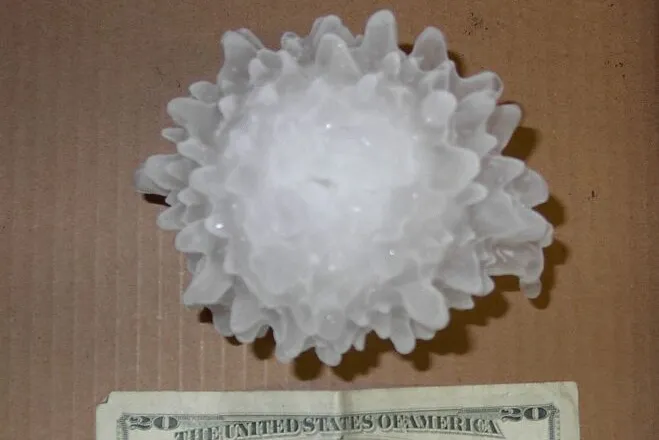
The softball-size hail that fell south of Chivington on September 20 tied the largest hailstone ever reported in Kiowa County, and it came three weeks later in the year than any big hail the county has on record.
The National Weather Service office in Pueblo has published a review of the storms. It counts five supercells that day on Colorado's eastern plains. A supercell is a thunderstorm that rotates, and it is the kind of storm that makes the biggest hail.
Two of the five crossed Kiowa County. One stone measured 4 inches across about three miles south of Chivington. Another measured 3.1 inches about nine miles south of Brandon.
Where it ranks
The Kiowa County Press checked those sizes against the Storm Prediction Center's national hail record, which runs from 1955 through 2025. It holds 321 hail reports from Kiowa County, the first from 1960.
- Only one other report in the county reaches 4 inches. It came from near Sheridan Lake on June 24, 2021.
- Only three more reach 3 inches. They are from 1994, 2018 and 2023.
- Before this storm, the largest hail reported in the county in September or later was 1.75 inches, on September 17, 1990.
- No hail of 2 inches or more had been reported in the county after August. The latest was on August 28, 2002.
Late-season hail this large is rare across the whole state. Of 68 Colorado reports of 4-inch hail or larger through 2025, only two came in September or later. One was in Rio Blanco County on September 20, 1997, the same date 29 years earlier. The other was in Bent County on October 11, 1997.
The state record is 5.25 inches, set in Yuma County on August 8, 2023.
This year's reports are still preliminary. The weather service makes them final months after a storm.
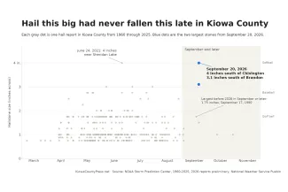
Every hail report in Kiowa County from 1960 through 2025, by size and time of year, with the two largest stones from September 20, 2026. Kiowa County Press chart; data from the NOAA Storm Prediction Center and the National Weather Service
The afternoon, hour by hour
The first storm formed near Limon and moved southeast for close to three hours. Reports sent to the weather service trace its path.
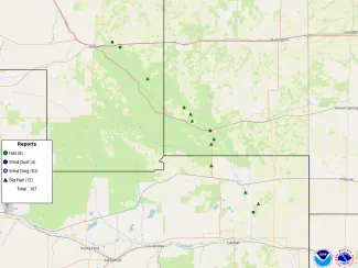
Storm reports from September 20, 2026. Triangles mark hail 2 inches or larger, in a line running southeast from near Limon past Eads. National Weather Service
- 3:33 p.m. Hail 2.5 inches across fell 10 miles north of Boyero in Lincoln County.
- 4:22 p.m. Baseball-size hail fell northeast of Wild Horse in Cheyenne County. It broke the windshield of a storm spotter's vehicle.
- 5:04 p.m. Baseball-size hail, 2.75 inches, was reported five miles north of Eads.
- 6:00 p.m. The 4-inch stone fell south of Chivington.
- 6:10 p.m. The 3.1-inch stone was measured south of Brandon.
- 6:33 p.m. Hail the size of ping pong balls fell east of Queens Reservoir.
The first storm faded near Eads. A second one formed just southeast of town, right beside it. That second storm dropped the largest hail, the weather service said.
Three more supercells formed after dark, between 9:00 and 10:00 p.m., in El Paso and Elbert counties. One led to a tornado warning in southeast El Paso County. No tornado was reported. Nobody sent in hail reports from the two El Paso County storms, but radar estimates showed hail of 2 inches or more, forecasters said.
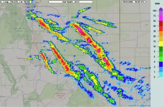
Radar-estimated hail along the paths of the September 20, 2026 storms. Colors show the estimated largest hail in millimeters: 25 mm is about 1 inch, 50 mm about 2 inches. National Weather Service; map data © OpenStreetMap contributors
Why it happened so late
A cold front had pushed across the plains. Behind it, wind near the ground blew from the southeast and carried moist air into the area. Higher up, the wind blew from the west and northwest, and it was much faster.
That change in wind with height is called wind shear. It measured more than 50 miles per hour that evening. Shear that strong lets a storm rotate and last for hours instead of raining itself out.
The air was also unstable, which means warm, moist air near the ground could rise fast. Most of that rising air was high enough to be below freezing. Hailstones grow there, and a strong updraft holds them up long enough to get big.
Conditions like those are more typical of early summer. They are unusual in late September, the weather service wrote, and more unusual after 9:00 p.m. Its Pueblo office issues only about 12 severe thunderstorm warnings in a typical September.
The forecast held up
Forecasters saw it coming. The Pueblo office's outlook that morning named hail up to 2 inches as a threat. The Storm Prediction Center also marked the area for severe hail and noted that very large stones were possible.
The hail that fell was twice the size in the morning outlook.