Warm, breezy Saturday in Kiowa County ahead of a much cooler Sunday

A warm and breezy Saturday across Kiowa County will give way to a much cooler, cloudier Sunday, as a stronger cold front pushes onto the eastern plains and brings showers and a chance of thunderstorms, the National Weather Service says.
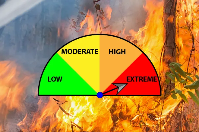
Eads can expect mostly sunny skies Saturday with a high near 88. Winds are the standout, shifting from the northwest at 15 to 20 mph to the northeast at 25 to 30 mph in the afternoon, with gusts as high as 40 mph. Breezy conditions and low humidity are keeping fire danger elevated across the plains, though no red flag warning is in effect for Kiowa County.
“Warm and breezy again today, with continued critical and near critical fire weather conditions,” a meteorologist with the National Weather Service in Pueblo wrote in Saturday’s Area Forecast Discussion. The office said a slug of moisture from the Desert Southwest would help touch off isolated to scattered showers and storms into the overnight hours.
A sharp weekend cooldown
The bigger change comes behind the front. After Saturday’s warmth, Sunday turns much cooler, with the high only near 70 under mostly cloudy skies and a 20 percent chance of showers, with a thunderstorm possible late in the day. Forecasters expect widespread showers and storms over the higher terrain Sunday afternoon, spreading east into the more stable air over the plains.
Eads, Colo. — Five-day forecast (June 13–17, 2026)
Source: National Weather Service, Pueblo — Issued June 13, 2026
| Period | Sky conditions | High / Low | Wind |
|---|---|---|---|
| Saturday | Mostly sunny, windy | High 88 | NW 15–20 mph, NE 25–30 in the afternoon; gusts to 40 mph |
| Saturday night | Increasing clouds; slight chance of storms, then showers | Low 50 | NE 20–30 mph, easing after midnight; gusts to 40 mph |
| Sunday | Mostly cloudy; slight chance of showers and storms | High 70 | NE 10–15 mph, becoming SE |
| Sunday night | Mostly cloudy; chance of showers and storms | Low 48 | E 5–15 mph |
| Monday | Partly sunny; slight chance of morning showers | High 80 | E 5–10 mph, becoming S |
| Monday night | Mostly clear | Low 51 | SE 5–10 mph, becoming NE |
| Tuesday | Sunny | High 92 | N 5–10 mph, becoming SSW |
| Tuesday night | Mostly clear | Low 57 | SSE near 10 mph |
| Wednesday | Sunny and hot | High 101 | W 10–15 mph |
| Wednesday night | Mostly clear | Low 57 | N 10–15 mph, increasing after midnight |
(Kiowa County Press)
Saturday and Sunday
Saturday night brings increasing clouds and a low around 50, with breezy northeast winds gusting to 40 mph before easing after midnight and a 30 percent chance of showers. Sunday’s cooler, overcast conditions stand in marked contrast with Saturday, and readers heading outdoors should plan for a wetter, breezier day.
Extended outlook
Temperatures rebound to begin the work week. Monday turns partly sunny with a high near 80 and a slight chance of morning showers, and Tuesday returns to sunshine with a high near 92. By Wednesday, sunny and hot conditions return, with a high near 101 as westerly flow rebuilds and the weather service warns that critical fire weather conditions could return to southeast Colorado.
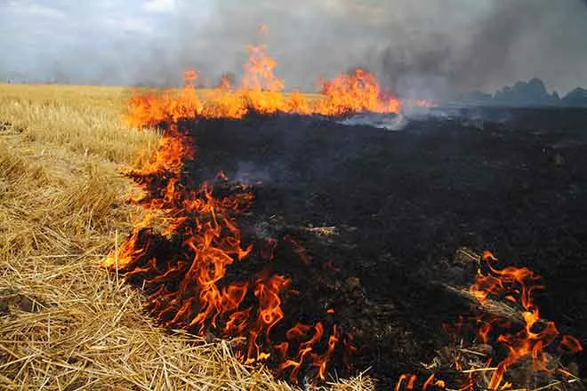
With gusty winds and dry fuels in place Saturday, residents are reminded to use caution with anything that could spark a grass fire.