Cooler Friday, warm weekend ahead for Cheyenne County

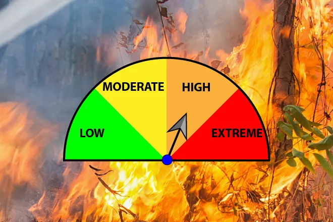
A cold front that swept through Cheyenne County Thursday left temperatures roughly 35 degrees cooler Friday, but the cooler air will be brief. Forecasters expect a rebound to the upper 70s by Saturday and the mid-80s by Sunday. A Fire Weather Watch has been issued for Cheyenne County for Saturday, with gusty south winds, low humidity and warming temperatures expected to create critical fire conditions through the afternoon and into the evening.
Friday will begin cloudy before clearing gradually through the afternoon, with a high near 53 degrees. North winds of 10 to 15 mph will shift to the southeast by afternoon, with gusts up to 30 mph. Temperatures will fall to around 31 degrees Friday night as south winds increase to 20 to 25 mph after midnight, with gusts up to 40 mph.
“Noticeably cooler on Friday, with highs in the 50s,” meteorologists in the National Weather Service office in Goodland, Kan., wrote in Thursday’s Area Forecast Discussion. “A warming trend and breezy south to southwest winds will follow on Saturday.”
Saturday: Fire weather watch in effect, high near 78
Saturday will be sunny with a high near 78 degrees. South winds of 15 to 25 mph with gusts as high as 45 mph are expected through the day. A Fire Weather Watch is in effect for Cheyenne County from 10 a.m. to 9 p.m. MDT Saturday, issued by the National Weather Service in Goodland, Kan. Forecasters cited the combination of warm temperatures, low relative humidity and sustained gusty winds as the primary drivers of elevated fire danger.
Residents are urged to avoid outdoor burning Saturday. Those in eastern Cheyenne County near the Colorado-Kansas border face the longest window of critical conditions, as the watch extends through the evening hours.
Saturday night will be partly cloudy with a low near 44 degrees. South winds of 5 to 15 mph will turn to the northwest after midnight.
Cheyenne Wells, Colo. — Five-day forecast (Fri. Mar 27 – Tue. Mar 31, 2026)
Source: National Weather Service, Goodland KS — Issued Mar 27, 2026
Period | Sky Conditions | High / Low | Wind |
|---|---|---|---|
| Fri. Mar 27 | Cloudy, clearing afternoon | High 53°F | N 10–15 mph, becoming SE, gusts to 30 mph |
| Fri. Night | Partly cloudy | Low 31°F | S 10–15 mph, increasing to 20–25 mph, gusts to 40 mph |
| Sat. Mar 28 | Sunny | High 78°F | S 15–25 mph, gusts to 45 mph — Fire Weather Watch |
| Sat. Night | Partly cloudy | Low 44°F | S 5–15 mph, becoming NW after midnight |
| Sun. Mar 29 | Sunny | High 85°F | NW ~10 mph, becoming S afternoon |
| Sun. Night | Partly cloudy | Low 46°F | Light and variable |
| Mon. Mar 30 | Partly sunny | High 84°F | Light and variable |
| Mon. Night | Partly cloudy | Low 47°F | Light winds |
| Tue. Mar 31 | Partly sunny | High 75°F | Breezy |
(Kiowa County Press)
Sunday through Tuesday: Continued warmth, light winds
Sunday will be sunny with a high near 85 degrees and light winds. Overnight will be partly cloudy with a low near 46 degrees.
Monday will be partly sunny with a high near 84 degrees and light winds. A low near 47 degrees is expected Monday night.
Tuesday will be partly sunny with a high near 75 degrees. Forecasters noted very low confidence in the specifics of Tuesday’s weather, with models showing significant divergence by midweek.
Extended outlook: Rain and snow possible by midweek
A more active and unsettled weather pattern is expected to develop across Cheyenne County by the middle of next week. Rain and snow showers are possible Tuesday night and Wednesday, with precipitation chances around 20 to 30 percent. Temperatures will cool noticeably heading into the middle of the week. Residents should monitor updated forecasts from the National Weather Service office in Goodland, Kan., at weather.gov as the week progresses.