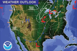
Hot, breezy Wednesday in Kiowa County before a sharp Thursday cooldown

Hot and breezy weather settles over Kiowa County to start the period, with sunny skies and a high near 98 in the Eads area Wednesday before a cold front sweeps south overnight and knocks Thursday's high back into the lower 80s.
Wednesday brings sunshine and gusty north-northwest winds of 15 to 20 mph, easing to around 10 to 15 mph through the day, with gusts as high as 35 mph. Skies stay mostly clear Wednesday night as the front arrives, dropping the overnight low to around 58 with breezy east winds.
Forecasters tied the heat to a persistent upper-level pattern. "Hot across the Plains," a meteorologist with the National Weather Service in Pueblo wrote in Wednesday's Area Forecast Discussion, noting that "highs across the Plains will reach into the upper 90s to lower 100s" before cooler air moves in.
A hot start, then a cooler turn
The same cold front responsible for Thursday's cooldown pushes south across the plains overnight Wednesday, ushering in much cooler air and turning winds to the northeast. Highs Thursday hold in the lower 80s across the area before temperatures rebound later in the week.
Kiowa County is not included in Wednesday's Red Flag Warning, which the Pueblo office issued from noon to 9 p.m. for the mountains and zones west of Interstate 25, where the strongest winds and lowest humidity are expected. Even so, hot temperatures and dry air make caution with any outdoor burning advisable across the eastern plains.
Eads, Colo. — Five-day forecast (June 17–21)
Source: National Weather Service, Pueblo — Issued June 17, 2026
| Period | Sky Conditions | High/Low | Wind |
|---|---|---|---|
| Wednesday | Sunny, breezy | 98 | NNW 15–20 mph becoming N 10–15 mph; gusts to 35 mph |
| Wed. night | Mostly clear, breezy | 58 | E 15–20 mph; gusts to 30 mph |
| Thursday | Becoming sunny | 83 | NNE 10–15 mph becoming SE |
| Thu. night | Mostly clear | 56 | SSE 10–15 mph |
| Friday | Sunny, breezy | 88 | S 10–15 mph increasing to 15–20 mph; gusts to 35 mph |
| Fri. night | Slight chance of storms, then partly cloudy | 57 | SE 15–20 mph decreasing to 10–15 mph; gusts to 30 mph |
| Saturday | Sunny, breezy | 98 | S 15–20 mph; gusts to 30 mph |
| Sat. night | Slight chance of storms | 59 | S near 20 mph becoming N; gusts to 30 mph |
| Sunday | Mostly sunny, slight chance of storms | 90 | N around 15 mph |
(Kiowa County Press)
Thursday and Friday
Thursday is the coolest day of the stretch, starting partly sunny and becoming sunny with a high near 83 and northeast winds of 10 to 15 mph turning southeast in the afternoon. The night stays mostly clear with a low around 56.
Friday, the Juneteenth holiday, warms back up under sunny skies to a high near 88, with breezy south winds increasing to 15 to 20 mph and gusts to 35 mph. A 30 percent chance of showers and thunderstorms arrives Friday night as the low drops to around 57.
Weekend outlook
Heat returns Saturday with sunny skies and a high near 98 on breezy south winds, and the Pueblo office flagged renewed fire-weather concerns for the region that day. "Strong winds and humidity values under 10 percent will lead to widespread high fire danger," the Wednesday discussion said. Saturday night carries a slight chance of storms with a low near 59.
Sunday turns a touch cooler behind another front, with mostly sunny skies, a high near 90 and a 10 percent chance of afternoon thunderstorms. Better rain chances build into early next week.
Residents are encouraged to stay hydrated during the hottest afternoons and to use caution with any activity that could spark a fire when winds are gusty and humidity is low.