Kiowa County weather outlook – week of June 14, 2020

Hot temperatures return to Kiowa County this week, will little chance of rain, offering no relief from recent drought expansion.
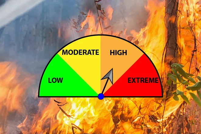
Saturday will see afternoon temperatures in the mid-90s, with south winds gusting to 30 miles per hour. A red flag warning for high fire danger will be in effect until 8:00 p.m. Overnight, temperatures are expected to drop to the mid-60s.
The red flag warning returns Sunday from noon until 8:00 p.m. as the temperature again reaches the mid-90s under mostly sunny skies. South wind continues, with gusts increasing to 40 mph. After 3:00 p.m., there is a slight chance of rain and thunderstorms. Wind decreases slightly Sunday evening, with gusts to 35 mph expected. Low 60s are expected overnight.
Temperatures trend slightly upward Monday and Tuesday, reaching the upper 90s under partly cloudy skies, while south winds drop to 10-15 mph. Overnight, temperatures fall to the low 60s.
By Wednesday, 10 mph wind shifts to the north as mid-90s return for the daytime high, and generally sunny skies prevail. Overnight, upper 50s are expected.
Thursday kicks off a slight cooling, with daytime temperatures reaching the low 90s, dropping back to the upper 50s overnight.
Cooler conditions continue Friday under sunny skies, with daytime temperatures around 90.