A magnitude 3.0 earthquake near Gallina is the 15th in the same corner of northern New Mexico since 2020

© iStock - allanswart
An earthquake of magnitude 3.0 struck northern New Mexico at 7:29 a.m. Sunday, November 15, about 2 miles north of the village of Gallina in Rio Arriba County, according to the U.S. Geological Survey. The epicenter was about 18 miles north-northeast of Cuba and 51 miles south of the Colorado line. No damage or injuries were reported.
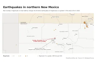
Earthquakes of magnitude 2 or greater in northern New Mexico and southern Colorado in 2026, with the November 15 magnitude 3.0 near Gallina in red and magnitude 2.5 or greater quakes from 2000 through 2025 in gray. Kiowa County Press map; data from the U.S. Geological Survey
The Geological Survey lists the quake as 3 kilometers north of Capulin, a Rio Arriba County community next to Gallina. It is not the Capulin in Union County near Capulin Volcano National Monument, about 160 miles to the east. Chama is 46 miles from the epicenter, Los Alamos 38, Santa Fe 63 and Pagosa Springs, Colorado, 71.
One person in the Gallina ZIP code had told the agency's "Did You Feel It?" survey by Sunday morning that they felt it, and rated the shaking weak. The Geological Survey has reviewed the event. It located the quake with readings from 16 seismic stations and puts the horizontal uncertainty at about 1.8 miles.
A familiar spot
Sunday's quake is the 15th of magnitude 2.5 or greater within 5 miles of the epicenter since July 2020, by the Geological Survey's count, and the largest there since July 2021.
The run began with a magnitude 3.7 on July 30, 2020, which 232 people reported feeling. A magnitude 3.3 followed on April 9, 2021. On July 12, 2021, five quakes struck within 11 hours, starting with a magnitude 3.0 at 7:44 a.m. The largest was a magnitude 4.2 at 9:33 a.m., about 3 miles east of Capulin, and a magnitude 3.7 followed half an hour later. It is the largest earthquake within 30 miles of Sunday's epicenter in the agency's catalog. Some 389 people told the Geological Survey they felt it, and the Santa Fe New Mexican reported at the time that it was felt as far away as Los Alamos and Santa Fe counties.
Since then, the quakes near Gallina have been smaller, magnitude 2.5 to 2.9, about once a year, most recently on December 7, 2025. Within 30 miles of Sunday's epicenter, the catalog lists 37 earthquakes of magnitude 2.5 or greater since 2008, 16 of them magnitude 3 or greater. Four came earlier this year, the largest a magnitude 3.5 on July 5 west of Los Ojos.
A busy year across New Mexico
The Geological Survey's catalog lists about 150 earthquakes of magnitude 2.5 or greater in New Mexico so far in 2026. More than half were in the oil fields of the Permian Basin in the southeast corner of the state, where the largest of the year, a magnitude 4.4, struck near Atoka on April 6.
The other busy area is the Raton Basin along the Colorado line west of Raton, where the Press has reported quakes in July, on November 1 and on November 8. Urbi Basu, the New Mexico Tech seismologist who manages the school's Seismological Observatory, told the Albuquerque Journal in July that the Raton Basin is "a known induced seismicity region," with quakes linked to coalbed methane production and the disposal of its wastewater.
The Gallina quakes are more than 100 miles west of the Raton Basin. The Geological Survey has not attributed Sunday's quake to any cause, and the Press found no published study of the Gallina cluster. After the 2021 quake, a Geological Survey geophysicist told the Santa Fe New Mexican that quakes of that size are not an everyday event in the region but not unusual either.
What to do
The Geological Survey asks anyone who felt the earthquake to report it on the event's page, where "Did You Feel It?" responses help map how far the shaking reached. For a larger quake, the advice from the Great ShakeOut drill is to drop, cover and hold on, stay away from windows, and if outdoors, move away from buildings and power lines.