Severe thunderstorm watches issued for most of Colorado Saturday

The National Weather Service has issued severe thunderstorm watches which cover 48 of Colorado’s 64 counties. The watches are expected to be in effect until 8:00 p.m. Saturday for central and eastern counties, and 5:00 p.m. for western areas.
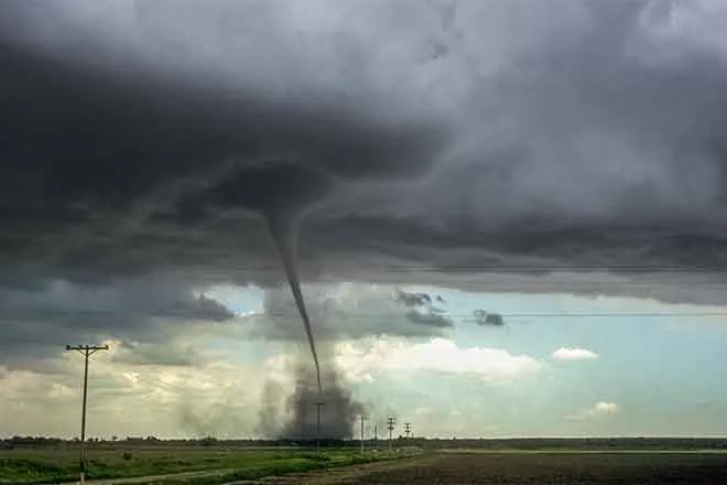
Damaging wind with gusts to 80 miles per hour are possible for much of the watch area where thunderstorms do occur. Isolated large hail – up to 1.5 inches in diameter – is a possibility. Tornado potential also exists for the western half of the state.
Counties NOT included in the watch:
Southwest
- Montrose
- Ouray
- San Miguel
- Dolores
- San Juan
- Montezuma
- La Plata
East
- Phillips
- Sedgwick
- Yuma
- Kit Carson
- Cheyenne
- Kiowa
- Bent
- Prowers
- Baca
The potential for rain gives hope to the nearly 1.4 million people living in drought-parched areas of the state. Over the past month, extreme drought - the second worst category - returned to the state for the first time in more than a year. At this same time last year, Colorado was free from all levels of drought and abnormally dry conditions for the first time in 19 years of record-keeping.
In addition to the thunderstorm watch, a high wind warning is in effect until 9:00 p.m. for all of eastern Colorado and the San Luis Valley. Sustained south winds to 40 mph are expected, with gusts to 60 mph possible.
As the afternoon progresses, severe thunderstorm warnings have been issued for portions of the western half of the state. A flash flood watch is also in effect for southwest Colorado counties through Saturday afternoon.