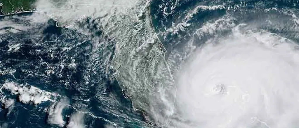
The first federal forecast for this year's Atlantic hurricane season indicates the possibility of a record number of named storms. Yet what does that mean in realms of safety considerations, and what tropical storm activity could occur on the other side of the county an ocean away? Rod Bain looks at the 2024 Hurricane Outlook in this edition of “Agriculture USA”.
PARTICIPANTS: Rod Bain. National Oceanic and Atmospheric Administration Administrator Rick Spinrad. National Weather Service Director Ken Graham. Federal Emergency Management Agency Deputy Administrator Eric Hooks. USDA meteorologist Brad Rippey.
Transcript
Might it be a record setting year for named tropical storms and hurricanes in the Atlantic Basin?
If you look at the accumulated cyclone energy of those storms, that is expected to be in the range of 150 to 245 percent of the long-term average.
When you add up all of the intensities and durations of the expected storms in 2024, it's likely to be very significantly above average.
I'm Ron Bain, USDA meteorologist Brad Rippey is among those joining us as we look at the forecast for both potential Atlantic and Pacific tropical storms and hurricanes in 2024 in this edition of Agriculture USA.
What are the percentages of an above average tropical storm and hurricane season in the Atlantic Basin in 2024?
The administrator of the National Oceanic and Atmospheric Administration, Rick Spinrad, offered that prognostication during the recent announcement of this year's hurricane outlook.
There's an 85 percent chance of an above normal season, a 10 percent chance of a near normal season and a 5 percent chance of a below normal season.
Put another way, that accuracy rate translates to...
Forecast for named storms, hurricanes and major hurricanes is the highest NOAA has ever issued for the May outlook.
That forecasted range?
Between 17 to 25 named storms, with between 8 to 13 of those storms predicted to become hurricanes and a range from 4 to 7 named storms elevating to major hurricane status.
That's category 3 or above.
So what are some of the factors behind the forecast?
The official CPC forecast indicates a 77 percent chance of La Nina forming during the August/October timeframe.
We know the development of La Nina can lead to weaker easterly trade winds and below average vertical wind shear in the tropical Atlantic Ocean.
This type of environment can be more conducive for tropical cyclone development.
In addition, record warm water temperatures are reported for much of the tropical Atlantic Ocean.
Forecast modeling indicates that above average sea surface temperatures are predicted during the peak months of the Atlantic hurricane season from August to October.
Warned sea surface temperatures, an important factor in rapid intensification of tropical cyclones to major hurricane status and that major hurricanes contribute significantly to the measurement of ACE, the accumulated cyclone energy, ACE.
And why ACE measurements are significant when it comes to forecasting Atlantic hurricane seasons is because...
In past years when we've seen high ACE numbers, those have historically been the years with the most destructive hurricanes and this season NOAA is forecasting the second highest ACE for our May outlook.
Now while National Weather Service Director Ken Graham says the Atlantic hurricane forecast sounds alarming, there is no need to be alarmed.
Especially if citizens and communities in potential impact zones take the time now to prepare for a potential tropical system.
He adds in preparations, it's not just winds that should concern persons about tropical storms and hurricanes.
We looked at 2013 to 2023 to really reevaluate some of the numbers and where we see the most fatalities. 90 percent of fatalities result from water.
He adds preparation for tropical storms is just not a coastal concern, but also in places far inland.
In 1969...
We had more direct fatalities during Hurricane Camila in Virginia than we did where the landfall was in Mississippi.
That was a category 5.
It was that inland rain.
Federal Emergency Management Agency Deputy Administrator Eric Hook says tropical storm and hurricane preparation involves taking time to understand a person's unique risk.
Do you have medication that requires refrigeration?
Do you have a medical device that requires electricity?
Do you have mobility challenges that make evacuations harder?
Now is the time to ask yourself these questions, understand your risk and put a plan in place so that you're prepared when disaster strikes.
With built in resiliency from preparation, jump starting any needed recovery efforts.
While significant tropical storm activity is expected in the Atlantic basin this summer and fall, opposite climate conditions and La Niña factors are found in the Pacific Basin, which USDA meteorologist Brad Rippey says is reflected in the 2024 tropical system forecast for that region.
Pretty good likelihood that we'll see below normal activity.
With National Weather Service forecast indicating there is...
A 60 percent likelihood of below average tropical activity in 2024 in the eastern Pacific.
The official eastern Pacific hurricane forecast calls for 11 to 17 named storms, 4 to 9 hurricanes and 1 to 4 major hurricanes this year.
This has been Agriculture USA.
I'm Rod Bain reporting for the U.S. Department of Agriculture in Washington, D.C.


