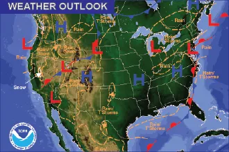
Cheyenne Wells, Cheyenne County warm and sunny Monday, showers possible Wednesday

Cheyenne Wells and Cheyenne County will see sunny, breezy and unseasonably warm weather Monday, with a high near 83 degrees, before cooler air and a chance of showers arrive Wednesday, according to the National Weather Service in Goodland, Kan.
Monday will be sunny and breezy, with a southwest wind of 15 to 20 mph decreasing to 10 to 15 mph in the afternoon. Gusts could reach 30 mph. Monday night will be clear, with a low around 54 and a southwest wind of 5 to 10 mph.
A meteorologist with the National Weather Service in Goodland, Kan., wrote in Sunday's Area Forecast Discussion to expect "mostly clear skies, well above average highs" and a south to southwest breeze of roughly 10 to 20 mph through Monday. Mid-October highs average in the upper 60s to lower 70s across the region.
Dry through Tuesday, wetter Wednesday
Forecasters said a wind shift and effective cold front should move through the region Tuesday, but that most guidance keeps the best moisture east of the Goodland area, so dry conditions are expected to persist through Tuesday.
Wednesday brings a 40 percent chance of showers, mainly before noon, with a high near 61. Showers become likely Wednesday night, with a possible thunderstorm and a 60 percent chance of precipitation. The Goodland discussion said confidence is higher for showers Wednesday night.
No Red Flag Warning is in effect for Cheyenne County. The Goodland discussion said minimum relative humidity Monday could drop to around 15 to 20 percent in eastern Colorado, with west-southwest winds of 10 to 20 mph and gusts up to about 25 mph in the morning, though it did not flag appreciable fire weather concerns for Sunday.
Cheyenne Wells, Colo. — Five-day forecast (Oct. 12–16)
Source: National Weather Service, Goodland, Kan. — Issued 10:51 p.m. MDT Oct. 11, 2026
| Period | Sky Conditions | High/Low | Wind |
|---|---|---|---|
| Monday | Sunny | High 83 | Southwest 15–20 mph, decreasing to 10–15 mph in afternoon; gusts to 30 mph |
| Monday night | Clear | Low 54 | Southwest 5–10 mph |
| Tuesday | Sunny | High 77 | West 5–10 mph, becoming east in afternoon |
| Tuesday night | Partly cloudy | Low 48 | Northeast 10–15 mph |
| Wednesday | Partly sunny; 40% chance of showers | High 61 | Not listed |
| Wednesday night | Showers likely; possible thunderstorm (60%) | Low 44 | Not listed |
| Thursday | Mostly sunny; 20% chance of showers before noon | High 62 | Not listed |
| Thursday night | Partly cloudy | Low 41 | Not listed |
| Friday | Sunny | High 57 | Not listed |
| Friday night | Mostly clear | Low 34 | Not listed |
(Kiowa County Press)
Tuesday and Wednesday
Tuesday will be sunny with a high near 77, a west wind of 5 to 10 mph turning east in the afternoon, and a partly cloudy night with a low around 48 and a northeast wind of 10 to 15 mph.
Wednesday will be partly sunny and noticeably cooler, with a high near 61 and a 40 percent chance of showers, mainly before noon. The low Wednesday night is forecast near 44.
Extended outlook: Thursday and Friday
Thursday has a 20 percent chance of showers before noon, then turns mostly sunny with a high near 62. Thursday night will be partly cloudy with a low around 41.
Friday will be sunny with a high near 57 and a low near 34. The Goodland discussion said there is medium confidence, about 45 percent, that a dry cold front will pass through Friday, and that Saturday should warm back into the 60s; the point forecast calls for a high near 64.
Residents should use extra caution with outdoor burning Monday, when the air will be dry and winds gusty, and may want to protect sensitive plants as Friday night's low nears freezing.