Cheyenne Wells nears 100 Wednesday as severe storms threaten Cheyenne County overnight

Cheyenne Wells heats to near 99 under sunny skies Wednesday before the week’s best chance of severe thunderstorms arrives Wednesday night, opening a cooler and wetter stretch that holds through the weekend, according to the National Weather Service in Goodland, Kan.
Wednesday is sunny and hot with a high near 99. Northwest winds of 5 to 10 mph turn southeast in the afternoon. Wednesday night carries a 40 percent chance of showers and thunderstorms, mainly between 9 and 11 p.m., with mostly cloudy skies gradually clearing and a low around 61.
“Best chance for severe weather looks to be on Wednesday. Large hail, damaging wind gusts, and flooding look to be the main threats,” the National Weather Service forecast office in Goodland, Kan., wrote in Tuesday’s Area Forecast Discussion.
Severe storm risk Wednesday night
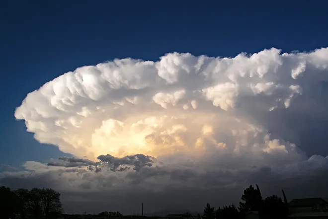
Forecasters expect a cold front to cross the area Wednesday, with storms developing near the higher terrain of Colorado and potentially organizing into a complex that moves into the region during the evening and overnight hours. Strong outflow winds are the most likely hazard, with the Goodland office noting the environment favors strong cold pools, while large hail, damaging wind gusts and flooding round out the main threats.
Behind the front, temperatures fall roughly 10 degrees for Thursday and keep easing through the weekend as moist southwesterly flow aloft brings daily storm chances. No fire weather warnings or heat advisories were in effect for Cheyenne County as of Tuesday afternoon; a Heat Advisory issued Tuesday covered only portions of northwest Kansas.
Cheyenne Wells, Colo. — Five-day forecast (Aug. 12-16, 2026)
Source: National Weather Service, Goodland, Kan. — Issued Aug. 11, 2026
| Period | Sky Conditions | High/Low | Wind |
|---|---|---|---|
| Wednesday | Sunny and hot | High 99 | NW 5-10 mph, becoming SE in the afternoon |
| Wednesday Night | Mostly cloudy, then clearing; 40% storms 9-11 p.m. | Low 61 | SE 5-10 mph, becoming N in the evening |
| Thursday | Mostly sunny | High 89 | N 5-15 mph, becoming E in the afternoon |
| Thursday Night | Mostly cloudy; 50% storms before midnight | Low 60 | E 5-10 mph, becoming N in the evening |
| Friday | Partly sunny; 20% storms after noon | High 86 | Light winds |
| Friday Night | Mostly cloudy; showers likely (70%) | Low 59 | Light winds |
| Saturday | Mostly sunny; 20% storms after noon | High 85 | Light winds |
| Saturday Night | Mostly cloudy; showers likely (70%) | Low 58 | Light winds |
| Sunday | Partly sunny; 30% storms after noon | High 83 | Light winds |
| Sunday Night | Mostly cloudy; showers likely (60%) | Low 58 | Light winds |
(Kiowa County Press)
Thursday and Friday
Thursday is mostly sunny and cooler with a high near 89 as north winds of 5 to 15 mph turn east in the afternoon. Storm chances return Thursday night, a 50 percent chance before midnight, with a low around 60.
Friday is partly sunny with a high near 86 and a 20 percent chance of afternoon showers and thunderstorms. Showers become likely Friday night, a 70 percent chance, with mostly cloudy skies and a low around 59.
Extended outlook: Saturday and Sunday
Saturday is mostly sunny with a high near 85 and a 20 percent chance of afternoon storms; showers are likely again Saturday night with a low around 58. Sunday turns partly sunny with a 30 percent chance of afternoon storms and a high near 83, and showers remain likely Sunday night with a low around 58.
With the week’s strongest storms possible Wednesday night, residents should have a way to receive warnings after dark and be prepared for sudden strong winds, hail and localized flooding. Through the weekend, avoid driving through flooded roadways.