Triple-digit heat and storm chances ahead for Lamar, Prowers County

Lamar and Prowers County will bake through the end of the week, with sunny skies, gusty winds and highs climbing from near 99 on Wednesday to 103 by Friday, along with a chance for a few strong to severe storms, the National Weather Service in Pueblo said.
Wednesday will be sunny and hot with a high near 99 and patchy smoke from area wildfires possible late morning into the afternoon. A slight chance of showers and thunderstorms is expected after about 3 p.m. Winds will be out of the south at 5 to 10 mph, becoming south-southeast at 10 to 15 mph in the afternoon.
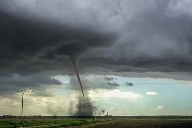
A meteorologist with the National Weather Service in Pueblo wrote in Tuesday's Area Forecast Discussion that increased low-level moisture across the plains, combined with ample wind shear, will support the potential for strong to severe storms capable of damaging winds and large hail across the far southeast plains.
Lamar, Colo. — Five-day forecast (July 1–5)
Source: National Weather Service, Pueblo — Issued June 30, 2026
| Period | Sky Conditions | High/Low | Wind |
|---|---|---|---|
| Wednesday | Sunny; patchy smoke | High 99 | S 5–10, becoming SSE 10–15 |
| Wednesday night | Partly cloudy; t-storms possible | Low 63 | S 15–20 mph, gusts to 30 |
| Thursday | Sunny and hot | High 102 | SW 10–20 mph, gusts to 30 |
| Thursday night | Mostly clear, windy | Low 66 | S 25–30 mph, gusts to 45 |
| Friday | Sunny and hot | High 103 | SW 5–15 mph, becoming SSE |
| Friday night | Mostly clear | Low 68 | SSE around 20 mph, gusts to 35 |
| Saturday (July 4) | Mostly sunny and hot | High 102 | W around 15 mph, becoming N |
| Saturday night | Partly cloudy | Low 63 | ENE 10–15 mph |
| Sunday | Mostly sunny | High 98 | NNE 10–15 mph, becoming ESE |
| Sunday night | Partly cloudy; t-storms possible | Low 62 | SE 5–15 mph |
(Kiowa County Press)
Severe storm and fire weather threats
Forecasters highlighted the far southeast plains, including Prowers County, as having the best chance of strong to severe storms, with damaging winds up to 70 mph and hail up to 1.5 inches in diameter possible. A renewed chance of severe storms across the far southeast plains was also flagged for Wednesday, where the Storm Prediction Center placed the area under a slight risk.
No Red Flag Warning was in effect for Prowers County as of Tuesday evening, with the Pueblo office's active fire weather warnings focused over and near the higher terrain to the west. Even so, with highs in the triple digits, very low humidity and gusty winds, fire conditions across the area will remain elevated, and patchy smoke from area wildfires may be noticeable at times.
Thursday and Friday bring the peak heat
Thursday will be sunny and hot with a high near 102 and a breezy southwest wind of 10 to 20 mph gusting to 30 mph. Winds turn windy overnight, with south gusts as high as 45 mph possible.
Friday is forecast to be the hottest day of the stretch, sunny with a high near 103. Forecasters said a bump in westerly flow will push temperatures into the 90s and lower 100s across the plains while keeping fire danger high.
Extended outlook
The Fourth of July, Saturday, will be mostly sunny and hot with a high near 102 and a west wind around 15 mph becoming north in the afternoon. Sunday turns slightly cooler, mostly sunny with a high near 98, before storm chances return Sunday night as the pattern slowly turns wetter into early next week.
Stay safe in the heat
With highs near or above the century mark and very low humidity expected, residents are encouraged to stay hydrated, limit strenuous outdoor activity during the heat of the day, never leave children or pets in parked vehicles and check on vulnerable family members and neighbors.