Lake Powell rose five feet in a week. Lake Mead is still at the bottom. What the Four Corners flood did, and did not do, for the Colorado River

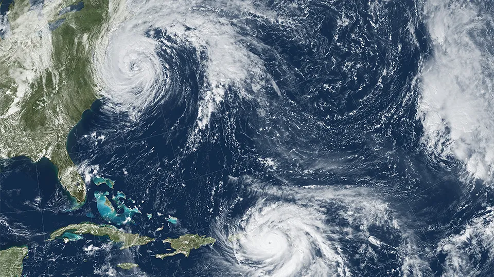
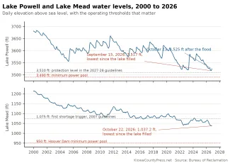
Three Pacific storms in five weeks have soaked the Southwest, and the third one, the remnants of Hurricane Trudy, turned into the flood that tore through southwest Colorado and northwest New Mexico on October 22 and 23. The water is now arriving in the Colorado River's two great reservoirs, or rather in one of them. Lake Powell stood at 3,525 feet on October 23, up five feet in a week and eight and a half feet above the record low it set September 15. Lake Mead set a new record low of its own on October 22.
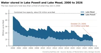
Together the two lakes held 12.3 million acre-feet of water on October 23, according to the Bureau of Reclamation. In October 2000 they held 43.3 million. On the same date in 2022, the low point of the last crisis, they held 13.2 million. The storms are real. So is the hole they are falling into.
©
What the storms brought
The remnants of Hurricane Polo crossed the Four Corners and southern Colorado at the end of September. Hurricane Rachel's remnants soaked Nevada and Utah on October 11 and 12, with a record 1.08 inches in Las Vegas, according to the National Weather Service. Then Trudy's remnants stalled over the San Juan Mountains on October 21 and dropped 4 inches or more in two days, from Wolf Creek Pass to the Conejos headwaters. The Press has a separate report on the flood itself.
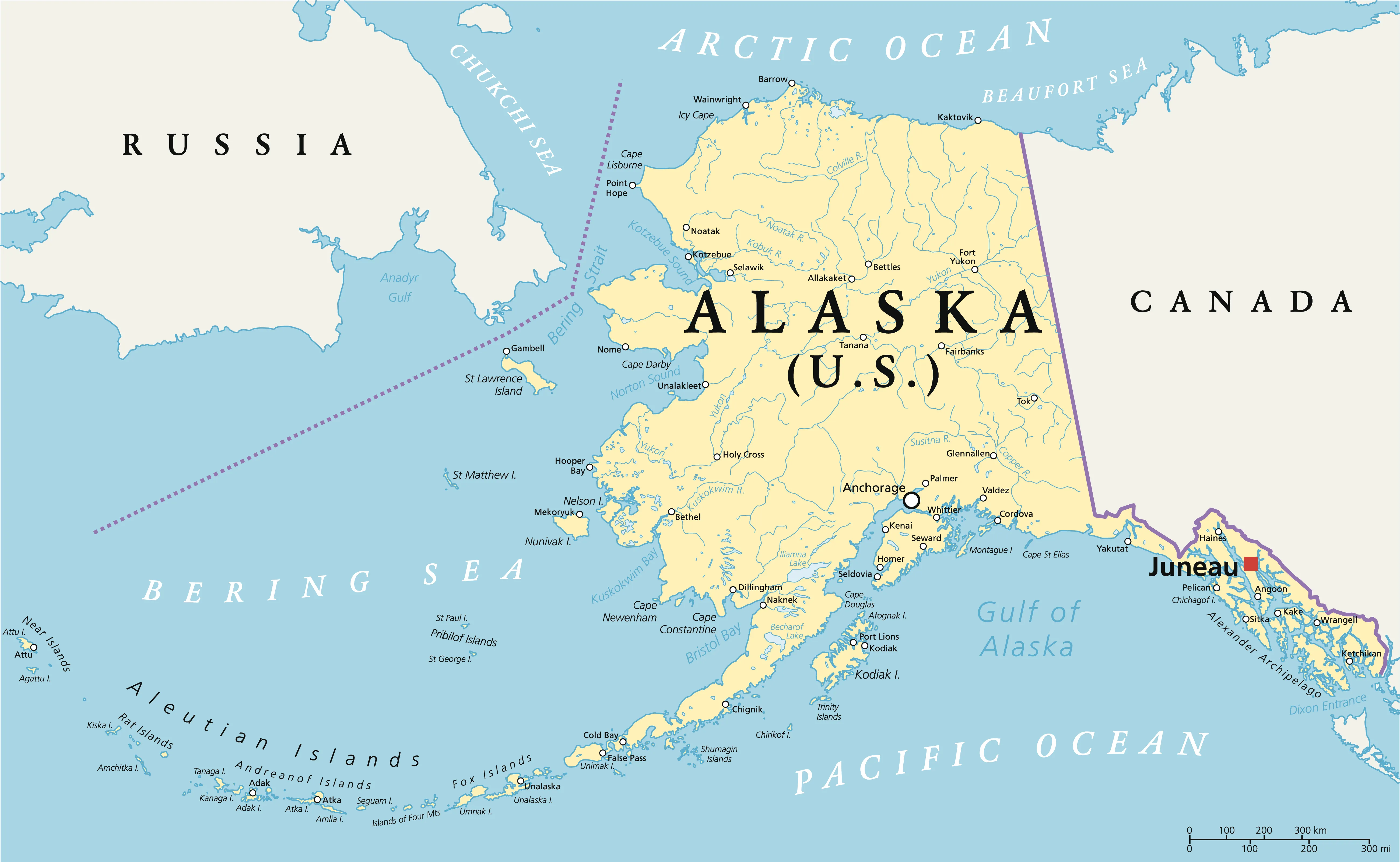
For the river, the difference between the three storms is where the rain fell. Polo and Rachel mostly rained below Glen Canyon Dam, or on country that drains to Lake Mead through the tributaries between the two lakes. Trudy rained on the San Juan, the Animas, the Piedra and the Dolores, which feed Lake Powell. The Piedra ran at twice its previous record, the San Juan at Four Corners at nearly four times its record, and Navajo Reservoir, which catches the upper San Juan, gained about 215,000 acre-feet between October 12 and October 24, going from 50 percent full to 62. Vallecito Reservoir above Durango went from 55 percent full on October 12 to 86 percent, and Lemon Reservoir from 59 to 83.
Lake Powell took in about 56,000 acre-feet on October 21, 104,000 on October 22 and 81,000 on October 23, against a Glen Canyon Dam release of about 13,000 acre-feet a day. Since October 12 the lake has gained about 340,000 acre-feet. It holds 5.5 million acre-feet, 24 percent of capacity. Reclamation's weekly update of October 18, written before the flood, already had the Upper Basin at 214 percent of normal precipitation for the water year that began October 1.
Lake Mead's level has little to do with any of it. It depends on how much Glen Canyon Dam lets through and how much Hoover Dam sends on to Arizona, California, Nevada and Mexico. Glen Canyon has released a steady 6,600 cubic feet per second all month. Hoover was releasing 8,000 to 10,000 until October 23, when it dropped to about 5,600, according to Reclamation's daily river report. The lake reached 1,037.16 feet on October 22, its lowest since it first filled, according to the agency's Lake Mead elevation records, and rose half a foot by October 24 only because less water was leaving. It holds 6.8 million acre-feet, 26 percent of capacity.
How the year went
The water year that ended September 30 was the one the river's managers had planned for and hoped not to see, as the Press reported in its water-year recap. Unregulated inflow to Lake Powell was 3.7 million acre-feet, 39 percent of normal. The April through July runoff, when the snowpack is supposed to melt and fill the lake, was 1.1 million acre-feet, 18 percent of normal. August brought 1,000 acre-feet, which Reclamation rounds to zero percent of average.
Reclamation responded in stages. In December it trimmed winter releases from Glen Canyon Dam to protect a target elevation of 3,525 feet. In the spring, with the lake headed below 3,500, the Interior Department cut the year's release from 7.48 million acre-feet to 6.0 million, the least the dam has released in a year under the current rules, and ordered up to a million acre-feet sent down from Flaming Gorge Reservoir in Utah and Wyoming by April 2027 to prop Powell up. Lower on the river, the states and Mexico left water in Lake Mead under conservation agreements that have been in place since 2023.
©
None of it was enough to keep Powell off a record low in September. The number that matters at Glen Canyon Dam is 3,490 feet, the minimum level at which the turbines can run. Below that, water can leave only through four bypass tubes near the base of the dam that were never built for continuous use. On September 15 the lake was 27 feet above that line.
Twenty-five years
In January 2000, Lake Powell was 88 percent full and Lake Mead 96 percent. The drought that began that year has never really ended. Powell lost two-thirds of its water by 2005. A wet 2011 filled it back to three-quarters. The big snow year of 2023 added about four million acre-feet to the two lakes combined and bought the river two years. The two years are up.
The rules changed along the way. The 2007 Interim Guidelines wrote down for the first time how the two lakes would be run together and when the Lower Basin would take cuts. The 2019 Drought Contingency Plan added deeper cuts. In August 2021 Reclamation declared the river's first shortage, for 2022, and the August 2026 study set a shortage condition again for 2027. Lake Mead has been in a shortage condition every year since, and Lake Powell has been operated under emergency provisions since 2022.
The 2007 guidelines expire at the end of this year. On August 21, the Interior Department issued the 2027-2028 Operating Guidelines that replace them, along with a 10-year framework that runs through 2036 and leaves room for the seven states to negotiate a longer agreement. The new rules cut Lower Basin deliveries by 1.25 million acre-feet in each of the next two years: 760,000 from Arizona, 440,000 from California and 50,000 from Nevada. For Lake Powell they set 3,510 feet as the level to protect and let Reclamation release anywhere from 6.0 to 7.0 million acre-feet in water year 2027, adjusting through April to hold the line. Blue Mesa, Flaming Gorge and Navajo can be drawn on again, under an agreement among the Upper Basin states, to help.
"Forty million people, millions of acres of farmland and ranchland, industries that power the American West" depend on the river, Interior Secretary Doug Burgum said in announcing the decision.
Colorado's reservoirs
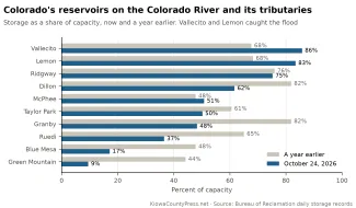
About a tenth of what is stored in Lake Powell and Lake Mead sits upstream in Colorado, in reservoirs on the Colorado River and its tributaries. Only Blue Mesa and Green Mountain are lower than the big two, but seven of the nine are lower than a year ago. The two that are higher sit where the flood fell.
©
Blue Mesa Reservoir on the Gunnison, the largest in the state, held 142,000 acre-feet on October 23, 17 percent of capacity, according to Reclamation's daily record. A year ago it was 48 percent full. Reclamation's records for Blue Mesa go back to its first filling in 1966, and it has never been this low since. July inflow was 18 percent of average. Green Mountain Reservoir on the Blue River, which stores water for the Western Slope to make up for what the Colorado-Big Thompson Project diverts to the Front Range, is at 9 percent of capacity, its lowest since 1963. Ruedi Reservoir on the Fryingpan is at 37 percent, its lowest since 1996.
Lake Granby, the heart of the Colorado-Big Thompson Project that sends Western Slope water to the Front Range, is 48 percent full against 82 percent a year ago. Dillon Reservoir, Denver Water's largest, is 62 percent full against 82. Taylor Park is at 50 percent and Ridgway on the Uncompahgre at 75. McPhee on the Dolores caught part of the flood and rose from 44 percent to 51.
The reservoirs the flood filled are the exceptions. Vallecito on the Los Pinos is 86 percent full, up from 68 percent a year ago, and Lemon on the Florida is 83 percent, up from 68. Both were below 30 percent at the start of September.
Flaming Gorge, the reservoir Reclamation is draining to help Powell, is at 64 percent, down from 79 percent a year ago. Navajo on the San Juan, which took the brunt of the flood, is at 62 percent.
Outlook
Reclamation's October 24-Month Study, released October 15, was the first in a long while to improve on the month before, and the flood has already overtaken it. The study put Lake Powell at 3,518.3 feet at the end of December. The lake passed that on October 16 and is now seven feet above it. September's unregulated inflow to Powell was 102 percent of average. For Lake Mead the study's most probable projection, which assumes a 6.0 million acre-foot release from Glen Canyon Dam, bottoms the lake at 1,007.73 feet in July 2027 and 1,009.85 feet in July 2028, where September's study had it below 1,000 feet. Powell is still expected to spend the coming water year in the new guidelines' infrastructure protection range, and the Flaming Gorge releases continue through April. The November study, due about November 13, will be the first to count the flood.
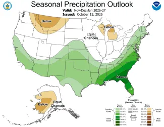
NOAA's winter outlook, issued October 15, leans the right way for the river's headwaters. The December through February precipitation outlook favors above-normal precipitation across the Southwest, the Four Corners and the southern and central Plains, with the strongest odds in Colorado over the southern and western mountains. Northern Colorado and the northern Rockies, where the Colorado's main stem and the Green River begin, are left at equal chances or tilted dry. The Climate Prediction Center gives an 80 percent chance that at least a strong El Niño lasts through March, expects it to fade to neutral by early summer, and sees a possible La Niña by the fall of 2027.
©
Whether 2027 is another 2026 or another 2023 depends on snow that has not fallen. The 2027-2028 guidelines and the decision documents are posted by Reclamation. Snowpack above Lake Powell does not usually begin to build until late October, and the forecast center's first snowpack-based runoff forecasts come in January. The center did issue an early estimate on October 1: 7.8 million acre-feet of unregulated inflow to Powell this water year, about 81 percent of average, with a range of 4.1 to 15.1 million. The storms of the past two weeks have wet the soil, which means more of the first snowmelt will reach the river instead of soaking in, and that is worth something. But the Colorado's year is made between December and April, in the mountains, and a very strong El Niño, now better than 80 percent likely to last through winter, has a mixed record there. The three strongest on record brought Colorado one huge winter and two ordinary ones.
The river has about 12 million acre-feet in the bank where it had 43 million a quarter-century ago. The flood has added about 340,000 of them so far, at a cost the Four Corners is still counting, and more is still draining in. It did not change the arithmetic.