Southeast Colorado weather outlook: Hot week ahead, monsoon begins
Increased temperatures are in store for southeast Colorado, including Kiowa and Cheyenne counties, for the week ahead.
Sunday starts off with highs in the mid-90s, with no expectation for rain, and lows dropping into the 60s. Rain was not expected Friday and Saturday, either, however a few brief thunderstorms crossed the area. The outlook from the Storm Prediction Center in Norman, Oklahoma, indicates surprise storms are unlikely for the start of the week.
In Kiowa County, highs in the mid- to upper 90s dominate through Thursday, with a very slight cooling to the low 90s expected Friday. Afternoon and evening thunderstorms are possible Tuesday through Thursday.
For Cheyenne County, the week kicks off with highs reaching 100 Monday and Tuesday before backing off to the mid- to upper 90s for the remainder of the work week. There is potential for afternoon and evening thunderstorms Wednesday through Friday.
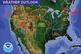
Midweek, monsoon moisture will reach southern Colorado as a high pressure system begins to compress to the south Wednesday and Thursday. That will bring the potential for rain and thunderstorms to Colorado’s southern mountains and potentially spreading to the eastern plains.
Heat Risk
The National Weather Service office in Pueblo will now be issuing alerts based upon heat risk. Potential alert products include Heat Advisory, Excessive Heat Warning, and Excessive Heat Watch. The Pueblo office previously did not issue these alert products since overnight temperatures were usually too cool to meet traditional heat-related criteria.
Since the mid-1950s, temperatures across southeast Colorado have been rising. The average number of days with temperatures reaching at least 100 degrees has increased from 2-3 per year to about 15 per year. At least five years since 2000 have 20 or more days at or above 100.
The week ahead offers potential for heat advisories to be issued for southeast Colorado, though none had been issued as of Sunday morning. The most likely areas to see heat advisories Monday and Tuesday are the southern Interstate 25 corridor, San Luis Valley and Wet Mountain Valley.
Nationally, heat advisories and excessive heat warnings remain in portions of Florida, Texas, New Mexico, Arizona, California, Nevada, and Utah. Heat advisories are also in place for much of southern Idaho, with temperatures in the upper 80s and low 90s, and eastern Montana, where temperatures at or above 100 are expected Sunday and Monday.
Temperature and Precipitation Forecast | ||||||
Eads | Cheyenne Wells | |||||
High | Low | Chance Precip. | High | Low | Chance Precip. | |
Sunday | 94 | 62 | 0% | 96 | 66 | 0% |
Monday | 96 | 65 | 0% | 100 | 66 | 0% |
Tuesday | 98 | 65 | 10% | 100 | 67 | 0% |
Wednesday | 96 | 64 | 30% | 98 | 67 | 20% |
Thursday | 95 | 63 | 20% | 95 | 64 | 30% |
Friday | 93 | 65 | 0% | 95 | 64 | 20% |

