Active Weather Extends Southeast - Tornadoes Possible
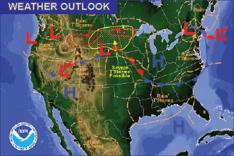
After a day that saw reports of heavy rain, flooding and two-inch hail in parts of northern Colorado, along with at least one tornado warning in Washington county, severe thunderstorm potential will extend to all the eastern border counties Sunday.
Eastern Colorado
Showers and thunderstorms will develop over the mountains during the early afternoon hours before spreading to the plains later in the day. The most severe storms will develop closer to the Colorado-Kansas and Colorado-Nebraska borders. Golf ball-size hail and wind gusts to 70 miles per hour will be possible. Southeast counties may see flash flooding. The greatest rainfall over the next two days will be in eastern Kiowa, Prowers and Baca counties, where more than an inch of rain is possible.
A few brief tornados are possible Sunday across southwest Kiowa, eastern Las Animas, and Otero, Bent, Prowers and Baca counties.
Temperatures across the eastern half of the state will be in the low to mid-80s Sunday. Mid- to upper 80s are expected Monday, with Sterling reaching 90. Low to mid-80s continue through Wednesday.
Chances for showers and thunderstorms will continue through at least the middle of the week.
Western Colorado
The west slope can expect some rain Sunday afternoon, though not as widespread and intense as recent days. Storms that do develop will begin over the higher elevations before spreading west. Wind gusts to 40 miles per hour, small hail and the occasional heavy rain are possible, with a few showers lingering overnight.
The potential for rain continues into the early part of the week, though it will be more limited than in the recent past.
Temperatures will be mainly in the low to mid-80s through Monday, with Grand Junction seeing upper 80s. Tuesday will be slightly cooler, with Craig and Montrose reaching the upper 70 while other areas can expect highs in the low 80s.
Low temperatures will be in the 50s for most areas, while Craig and Cortez drop to the upper 40s.
Colorado Weather Updates
Weather information is updated throughout the date at http://KiowaCountyPress.net/weather
If you experience severe weather today (or any day), please send us your reports! #cowx pic.twitter.com/3MShOAnYUL
— NWS Pueblo (@NWSPueblo) August 13, 2017
Forecast - August 13 - 16 | ||||||||
Sunday | Monday | Tuesday | Wednesday | |||||
City | High | Low | High | Low | High | Low | High | Low |
Eads | 84 | 59 | 87 | 62 | 88 | 60 | 84 | 59 |
Springfield | 83 | 60 | 86 | 62 | 89 | 61 | 84 | 60 |
Trinidad | 82 | 57 | 85 | 57 | 85 | 55 | 82 | 54 |
Limon | 81 | 54 | 86 | 58 | 82 | 55 | 79 | 54 |
Sterling | 86 | 57 | 90 | 61 | 85 | 58 | 80 | 57 |
Fort Morgan | 86 | 57 | 89 | 60 | 85 | 57 | 81 | 56 |
Craig | 81 | 50 | 83 | 52 | 79 | 47 | 80 | 48 |
Grand Junction | 88 | 61 | 89 | 62 | 86 | 59 | 88 | 60 |
Montrose | 80 | 55 | 83 | 56 | 79 | 52 | 80 | 53 |
Cortez | 83 | 51 | 83 | 53 | 80 | 49 | 82 | 49 |


