Hot Dry Weekend Ahead for Colorado
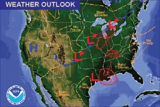
The heavy rains from earlier in the month are firmly in the past as the weekend sets up for hot days with little chance of storms.
Eastern Colorado
High pressure persists across the eastern plains, with drier air working its way into the region. While a few showers may be possible, coverage will be limited mainly to higher elevations.
Temperatures will be near seasonal norms through the weekend, with mid-80s across much of the central plains, including Eads and La Junta, and low 90s further north in the Sterling and Fort Morgan areas. Further to the southeast, Springfield will see low 80s, while Kim will reach the upper 70s.
Overnight lows will be in the mid-50s to low 60s.
The potential for moisture increases slightly late Sunday into Monday as a front moves through the southeast part of the state.
Western Colorado
The west slope will mainly be in the mid- to upper 80s over the coming days, with Grand Junction remaining the hot spot with low to mid-90s. A few showers and thunderstorms are possible over the mountains.
Overnight lows will be in the mid-50 to low 60, though Craig will drop to the upper 40s.
Chances of rain increase slightly as the weekend progresses.
Weather information updated throughout the day is available at http://KiowaCountyPress.net/weather
Forecast - August 25-28 | ||||||||
Friday | Saturday | Sunday | Monday | |||||
City | High | Low | High | Low | High | Low | High | Low |
Eads | 86 | 59 | 88 | 59 | 87 | 58 | 85 | 57 |
Springfield | 84 | 61 | 86 | 61 | 87 | 59 | 83 | 58 |
Trinidad | 82 | 55 | 83 | 57 | 83 | 55 | 83 | 55 |
Limon | 87 | 54 | 89 | 54 | 83 | 53 | 84 | 54 |
Sterling | 90 | 57 | 92 | 58 | 86 | 56 | 87 | 57 |
Fort Morgan | 91 | 57 | 93 | 57 | 87 | 57 | 88 | 58 |
Craig | 84 | 48 | 87 | 48 | 88 | 49 | 86 | 49 |
Grand Junction | 91 | 60 | 94 | 62 | 94 | 62 | 92 | 62 |
Montrose | 86 | 55 | 88 | 55 | 88 | 56 | 86 | 56 |
Cortez | 86 | 53 | 88 | 53 | 88 | 54 | 86 | 53 |

